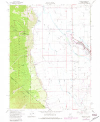
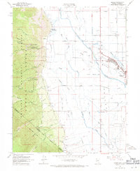
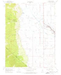
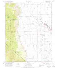
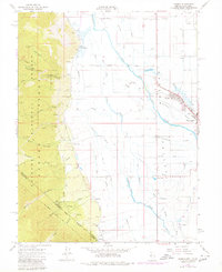
1968 Map of Minden
USGS Topo · Published 1983About this map
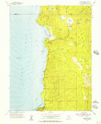
The Carson Valley is meticulously detailed in this late 1960s study, showcasing the agricultural and transport corridors of Douglas Co. The map centers on the high-desert settlements of Minden and Gardnerville, where the East Fork Carson River gives rise to an intricate system of irrigation ditches and sloughs, including Martin Slough and Cottonwood Slough. To the west, the Carson Range rises abruptly from the valley floor, marked by the steep ascent of the Kingsbury Grade and Daggett Pass Road into the Toiyabe National Forest. This document is particularly valuable for genealogists, as it identifies small outlying communities like Mottsville, Centerville, and Sheridan, alongside family and local landmarks such as the Mottsville Cem, Captain George Cem, and the prominent Walleys Hot Springs.
Find a feature on this map
51 named features on this map. Tap any name to fly to it.
Don’t see what you’re looking for? This feature index may not catch every label — zoom into the map to look around manually.
Map Details
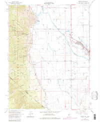
Editions of this 1968 Minden Map
6 editions found
Other maps of this area

1889 · Markleeville
USGS Topo · 1:125,000

1891 · Carson
USGS Topo · 1:125,000

1891 · Markleeville
USGS Topo · 1:125,000

1893 · Carson
USGS Topo · 1:125,000

1893 · Markleeville
USGS Topo · 1:125,000

1948 · Walker Lake
USGS Topo · 1:250,000
1955 · Freel Peak
USGS Topo · 1:24,000
1955 · Bijou
USGS Topo · 1:24,000
1955 · Glenbrook
USGS Topo · 1:24,000

1956 · Freel Peak
USGS Topo · 1:62,500