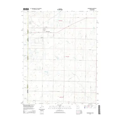
2015 Map of Mindenmines
USGS Topo · Published 2015About this map
Mindenmines anchors this portion of Barton County along the western border where Missouri meets Kansas. The landscape is heavily defined by the upper reaches of Glendale Fork and Blackberry Cr, which wind through a terrain marked by numerous artificial water bodies including the distinctively named Number 180 Reservoir. This area reflects a mid-continent rural structure where small family cemeteries like Yale Cemetery and the Mindenmines Cemetery serve as local landmarks among a precise grid of county roads.
Find a feature on this map
46 named features on this map. Tap any name to fly to it.
Don’t see what you’re looking for? This feature index may not catch every label — zoom into the map to look around manually.
Map Details
Editions of this 2015 Mindenmines Map
This is the sole edition of this map. No revisions or reprints were ever made.
Other maps of this area

1884 · Fort Scott
USGS Topo · 1:125,000

1886 · Nevada
USGS Topo · 1:125,000

1886 · Joplin
USGS Topo · 1:125,000

1886 · Fort Scott
USGS Topo · 1:125,000

1886 · Carthage
USGS Topo · 1:125,000

1893 · Fort Scott
USGS Topo · 1:125,000

1894 · Nevada
USGS Topo · 1:125,000

1894 · Joplin
USGS Topo · 1:125,000

1894 · Carthage
USGS Topo · 1:125,000

1945 · Pittsburg
USGS Topo · 1:62,500