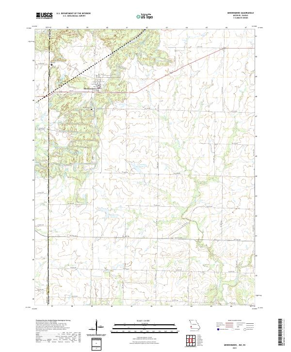
2021 Map of Mindenmines
USGS Topo · Published 2021About this map
Mindenmines sits at the heart of this landscape along the Kansas-Missouri state line, where the residential grid of 3rd St and Pacific St meets the rural expanses of Barton County. The terrain is defined by a complex network of small waterways and engineered water bodies, including Gardner Farms Lake and the Number 180 Reservoir, which interrupt the traditional section-line road system. For genealogists, the map identifies local burial sites such as Mindenmines Cem and Yale Cem, providing precise locations for family history research. The presence of numerous small ponds and the drainage of Glendale Fork suggest a history of land modification, likely tied to the region's historical mining activities, even as much of the area has transitioned back to agricultural use or natural water storage.
Find a feature on this map
46 named features on this map. Tap any name to fly to it.
Don’t see what you’re looking for? This feature index may not catch every label — zoom into the map to look around manually.
Map Details
Editions of this 2021 Mindenmines Map
This is the sole edition of this map. No revisions or reprints were ever made.
Other maps of this area

1884 · Fort Scott
USGS Topo · 1:125,000

1886 · Nevada
USGS Topo · 1:125,000

1886 · Joplin
USGS Topo · 1:125,000

1886 · Fort Scott
USGS Topo · 1:125,000

1886 · Carthage
USGS Topo · 1:125,000

1893 · Fort Scott
USGS Topo · 1:125,000

1894 · Nevada
USGS Topo · 1:125,000

1894 · Joplin
USGS Topo · 1:125,000

1894 · Carthage
USGS Topo · 1:125,000

1945 · Pittsburg
USGS Topo · 1:62,500