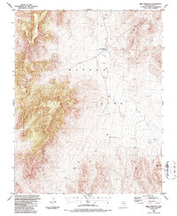
1986 Map of Mine Mountain
USGS Topo · Published 1987About this map
The Nevada Test Site dominates this mid-1980s topographic record of Nye County, documenting a landscape defined by both massive geological formations and strategic twentieth-century infrastructure. The high peaks of Shoshone Mountain and Mine Mountain frame the arid expanse of Mid Valley, where specialized labels like Heliport, Radio Towers, and Drill Hole point to the technical operations typical of this government installation. The intersection at Mine Mountain Junction provides a focal point for the limited road network that traverses the desert floor near Barren Spot.
Find a feature on this map
15 named features on this map. Tap any name to fly to it.
Don’t see what you’re looking for? This feature index may not catch every label — zoom into the map to look around manually.
Map Details
Editions of this 1986 Mine Mountain Map
This is the sole edition of this map. No revisions or reprints were ever made.
Other maps of this area

1908 · Kawich
USGS Topo · 1:250,000

1908 · Furnace Creek
USGS Topo · 1:250,000

1910 · Furnace Creek
USGS Topo · 1:250,000

1942 · Wheelbarrow Peak
USGS Topo · 1:125,000

1942 · Skull Mountain
USGS Topo · 1:125,000

1948 · Death Valley
USGS Topo · 1:250,000

1952 · Topopah Spring
USGS Topo · 1:62,500

1952 · Tippipah Spring
USGS Topo · 1:62,500

1952 · Timber Mountain
USGS Topo · 1:62,500
1952 · Cane Spring
USGS Topo · 1:62,500