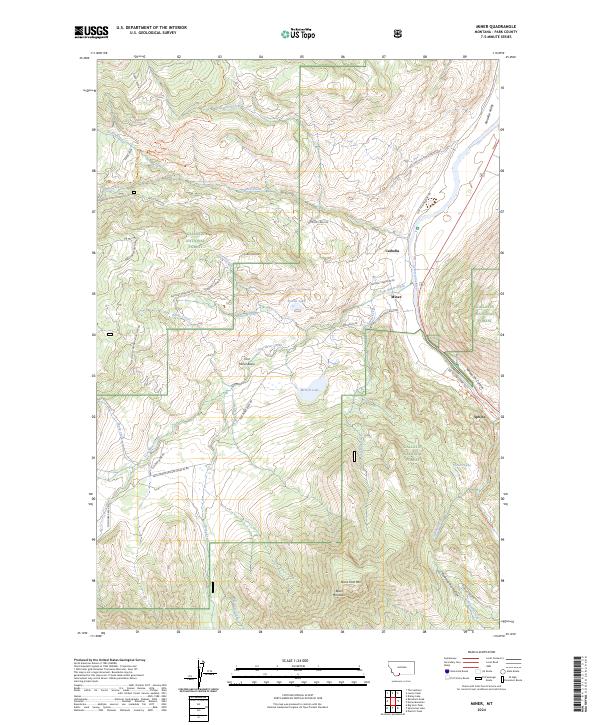
2024 Map of Miner
USGS Topo · Published 2024About this map
The Yellowstone River cuts a deep path through the eastern edge of this landscape, framing the southern reach of Paradise Valley and the narrows of Yankee Jim Canyon. This area, situated within the Gallatin National Forest, is defined by a network of historic pathways and remote settlements. The small community of Miner sits along the Tom Miner Creek, while Carbella marks a crossing point further north. High-altitude landmarks like Black Mountain and Crystal Cross Mtn overlook the Tom Miner Basin, a prominent geographic depression west of the river. Evidence of earlier transit remains visible through the Old Yellowstone Trl and the Fisher Wagon Route Trl, tracing the movement of travelers and settlers long before modern infrastructure dominated these mountain passes.
Find a feature on this map
50 named features on this map. Tap any name to fly to it.
Don’t see what you’re looking for? This feature index may not catch every label — zoom into the map to look around manually.
Map Details
Editions of this 2024 Miner Map
This is the sole edition of this map. No revisions or reprints were ever made.
Other maps of this area

1888 · Three Forks
USGS Topo · 1:250,000

1891 · Livingston
USGS Topo · 1:250,000

1893 · Livingston
USGS Topo · 1:250,000

1894 · Three Forks
USGS Topo · 1:250,000

1895 · Three Forks
USGS Topo · 1:250,000

1947 · Bozeman
USGS Topo · 1:250,000

1948 · Bozeman
USGS Topo · 1:250,000

1955 · Bozeman
USGS Topo · 1:250,000

1955 · Garnet Mountain
USGS Topo · 1:62,500

1955 · Fridley Peak
USGS Topo · 1:62,500