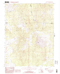
1987 Map of Mineral Peak
USGS Topo · Published 1993About this map
The high ridges of the Pine Nut Mountains dominate this landscape along the borders of Carson City and Douglas County, where the terrain is marked by legacy mining operations and vital water sources. Mining activity is central to the area's history, represented by the June Ellen Mine and the Utopian Mine, as well as a designated Mine Shaft. These sites are concentrated near the northern end of the range, transitioning into the steep drainages of Eldorado Canyon. Localized hydrology is critical in this arid environment, with Erastra Spring and Lebo Spring providing reliable water points for prospectors and wildlife alike. The topography culminates at prominent heights such as Bismark Peak and Mineral Peak, overlooking the expansive Mineral Valley to the east.
Find a feature on this map
13 named features on this map. Tap any name to fly to it.
Don’t see what you’re looking for? This feature index may not catch every label — zoom into the map to look around manually.
Map Details
Editions of this 1987 Mineral Peak Map
Other maps of this area

1889 · Markleeville
USGS Topo · 1:125,000

1891 · Carson
USGS Topo · 1:125,000

1891 · Markleeville
USGS Topo · 1:125,000

1891 · Wabuska
USGS Topo · 1:125,000

1891 · Wellington
USGS Topo · 1:125,000

1893 · Carson
USGS Topo · 1:125,000

1893 · Markleeville
USGS Topo · 1:125,000

1893 · Wellington
USGS Topo · 1:125,000

1894 · Wabuska
USGS Topo · 1:125,000

1948 · Walker Lake
USGS Topo · 1:250,000