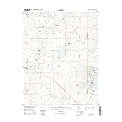
2015 Map of Mineral Point
USGS Topo · Published 2015About this map
Potosi and the surrounding mineral-rich district of Washington Co reflect a landscape shaped by both early mining heritage and modern water management. The terrain transitions from the eastern edge of the Saint Francois Mountains into a series of valleys marked by historic settlements like Mineral Point, Cadet, and French Town. Resource extraction is evident through features such as the Cadet Tailings Pond Number 2 and the Hornsey Brothers Tailings Pond, which sit near Mill Creek. Genealogists will find a high density of family-named burial grounds, including the Aquilla Cole Cemetery, Jarvis Farm Cemetery, and Boas Cemetery. To the southeast, the residential development of Terre du Lac is defined by a network of man-made lakes such as Lac Carmel, Lac Catalina, and Lac Bourbon, contrasting with the more rural character of Summit and Hopewell.
Find a feature on this map
156 named features on this map. Tap any name to fly to it.
Don’t see what you’re looking for? This feature index may not catch every label — zoom into the map to look around manually.
Map Details
Editions of this 2015 Mineral Point Map
This is the sole edition of this map. No revisions or reprints were ever made.
Other maps of this area

1901 · De Soto
USGS Topo · 1:125,000

1905 · Bonneterre
USGS Topo · 1:62,500

1906 · Potosi
USGS Topo · 1:62,500

1931 · De Soto SE
USGS Topo · 1:24,000

1937 · Tiff
USGS Topo · 1:24,000

1939 · Tiff
USGS Topo · 1:24,000

1946 · Richwoods
USGS Topo · 1:62,500

1948 · Richwoods
USGS Topo · 1:62,500

1949 · Saint Louis
USGS Topo · 1:250,000

1949 · Rolla
USGS Topo · 1:250,000