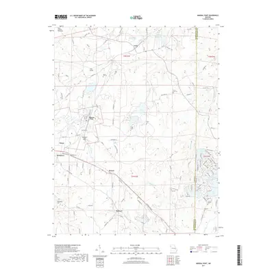
2017 Map of Mineral Point
USGS Topo · Published 2017About this map
Industrial mining legacies and rural settlements intersect in this corner of the Saint Francois Mountains. The landscape is notably marked by massive waste management features like Cadet Tailings Pond Number 2 and the Hornsey Brothers Tailings Pond, reflecting the long-standing mineral extraction history of the region. Nearby, the community of Mineral Point and the outlying Washington County Airport serve as central hubs for a network of winding country roads and creek valleys.
Find a feature on this map
133 named features on this map. Tap any name to fly to it.
Don’t see what you’re looking for? This feature index may not catch every label — zoom into the map to look around manually.
Map Details
Editions of this 2017 Mineral Point Map
This is the sole edition of this map. No revisions or reprints were ever made.
Other maps of this area

1901 · De Soto
USGS Topo · 1:125,000

1905 · Bonneterre
USGS Topo · 1:62,500

1906 · Potosi
USGS Topo · 1:62,500

1931 · De Soto SE
USGS Topo · 1:24,000

1937 · Tiff
USGS Topo · 1:24,000

1939 · Tiff
USGS Topo · 1:24,000

1946 · Richwoods
USGS Topo · 1:62,500

1948 · Richwoods
USGS Topo · 1:62,500

1949 · Saint Louis
USGS Topo · 1:250,000

1949 · Rolla
USGS Topo · 1:250,000