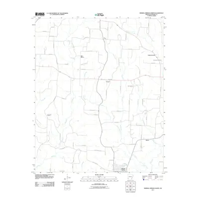
2011 Map of Mineral Springs North
USGS Topo · Published 2011About this map
Mineral Springs anchors the southern edge of this Howard County landscape, where the town's grid meets the headwaters of Mine Creek. To the north, the terrain is defined by the winding course of Blue Bayou and its tributaries, including Lefever Creek and Starch Creek. This era shows a community structured around rural intersections and family-named roads like Yates Rd and Corn Bridge Rd, supporting a network of local landmarks essential for genealogical research. Four distinct burial grounds, including Shiloh Cemetery and Bluff Springs Cemetery, are scattered across the map, often situated near small settlements like Temperanceville and Midway. The presence of York Chapel and the County Line Cemetery further illustrates the established social fabric of this rural Arkansas district as it transitioned into the early 21st century.
Find a feature on this map
66 named features on this map. Tap any name to fly to it.
Don’t see what you’re looking for? This feature index may not catch every label — zoom into the map to look around manually.
Map Details
Editions of this 2011 Mineral Springs North Map
This is the sole edition of this map. No revisions or reprints were ever made.
Other maps of this area

1906 · Caddo Gap
USGS Topo · 1:125,000

1913 · De Queen
USGS Topo · 1:125,000

1950 · Mcalester
USGS Topo · 1:250,000

1950 · Ben Lomond
USGS Topo · 1:24,000

1951 · Ben Lomond
USGS Topo · 1:24,000

1951 · Mineral Springs South
USGS Topo · 1:24,000

1951 · Columbus
USGS Topo · 1:24,000

1951 · Mineral Springs North
USGS Topo · 1:24,000

1951 · Nashville
USGS Topo · 1:24,000

1951 · Silver Ridge
USGS Topo · 1:24,000