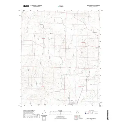
2020 Map of Mineral Springs North
USGS Topo · Published 2020About this map
Mineral Springs and the outskirts of Nashville anchor this landscape in Howard County, where the terrain is defined by the winding course of Blue Bayou. The map illustrates a rural network of small communities and family burial grounds, including the Shiloh Cem and Temperanceville Cem, linked by a series of local connectors like Old Military Rd and Dillard Creek Rd. The presence of the Glenn Winchester Airport near the southern edge reflects the area's modern infrastructure amidst its agricultural roots. The complex drainage of the region is evident through numerous waterways such as Temperanceville Cr, Lefever Cr, and Starch Cr, which flow toward the bayou. This document provides a detailed look at the interface between established settlements like Midway and the surrounding timber and farmland during the early 21st century.
Find a feature on this map
81 named features on this map. Tap any name to fly to it.
Don’t see what you’re looking for? This feature index may not catch every label — zoom into the map to look around manually.
Map Details
Editions of this 2020 Mineral Springs North Map
This is the sole edition of this map. No revisions or reprints were ever made.
Other maps of this area

1906 · Caddo Gap
USGS Topo · 1:125,000

1913 · De Queen
USGS Topo · 1:125,000

1950 · Mcalester
USGS Topo · 1:250,000

1950 · Ben Lomond
USGS Topo · 1:24,000

1951 · Ben Lomond
USGS Topo · 1:24,000

1951 · Mineral Springs South
USGS Topo · 1:24,000

1951 · Columbus
USGS Topo · 1:24,000

1951 · Mineral Springs North
USGS Topo · 1:24,000

1951 · Nashville
USGS Topo · 1:24,000

1951 · Silver Ridge
USGS Topo · 1:24,000