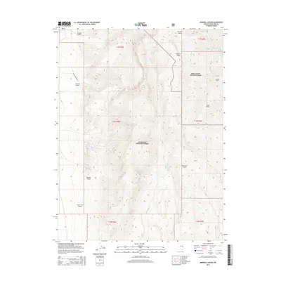
2014 Map of Minerva Canyon
USGS Topo · Published 2014About this map
Great Basin National Park and the Humboldt National Forest dominate this high-altitude landscape in the eastern Great Basin. Centered on the Snake Range, the map documents a series of dramatic drainages including Minerva Canyon, Silver Chief Canyon, and Swallow Canyon. To the north, the sharp elevation of Granite Peak and the spine of Highland Ridge define the topography, while ephemeral water sources like Mustang Spring and Decathon Spring provide rare points of relief in the arid environment. The only significant human transit corridor is Swallow Canyon Rd, which cuts through the northwestern portion of the quadrangle. This 2014 survey serves as a modern record of protected federal lands and the complex drainage networks of Johns Wash and Murphy Wash.
Find a feature on this map
23 named features on this map. Tap any name to fly to it.
Don’t see what you’re looking for? This feature index may not catch every label — zoom into the map to look around manually.
Map Details
Editions of this 2014 Minerva Canyon Map
This is the sole edition of this map. No revisions or reprints were ever made.
Other maps of this area

1948 · Wheeler Peak
USGS Topo · 1:62,500

1949 · Garrison
USGS Topo · 1:62,500

1950 · Wheeler Peak
USGS Topo · 1:62,500

1951 · Garrison
USGS Topo · 1:62,500

1956 · Lund
USGS Topo · 1:250,000

1960 · Lund
USGS Topo · 1:250,000

1972 · Big Springs
USGS Topo · 1:24,000

1973 · Indian Springs Knolls
USGS Topo · 1:24,000

1973 · Red Ledges
USGS Topo · 1:24,000
1979 · Garrison
USGS Topo · 1:100,000