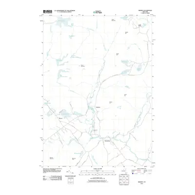
2010 Map of Minerva
USGS Topo · Published 2010About this map
Olmstedville and Minerva serve as the primary hubs of this landscape, situated along a network of winding local roads that follow the natural contours of the Adirondack terrain. The settlement pattern reveals the historic importance of the Minerva Stream corridor, which connects the smaller hamlet of Irishtown to the larger centers. Local history is preserved at sites like the Federal Flat Cemetery and Old Cemetary, while the surrounding geography is defined by a dense concentration of water bodies, including Hewitt Pond, Stony Pond, and the secluded Loch Muller in the northeast corner. Higher elevations such as Moxham Mountain and Green Mountain overlook a complex drainage system where Falls Brook and Trout Brook carve through the wooded hills, illustrating the enduring relationship between these upland communities and their water sources.
Find a feature on this map
63 named features on this map. Tap any name to fly to it.
Don’t see what you’re looking for? This feature index may not catch every label — zoom into the map to look around manually.
Map Details
Editions of this 2010 Minerva Map
This is the sole edition of this map. No revisions or reprints were ever made.
Other maps of this area

1895 · North Creek
USGS Topo · 1:62,500

1897 · North Creek
USGS Topo · 1:62,500

1897 · Schroon Lake
USGS Topo · 1:62,500

1898 · Newcomb
USGS Topo · 1:62,500

1898 · Thirteenth Lake
USGS Topo · 1:62,500

1901 · Newcomb
USGS Topo · 1:62,500

1950 · Glens Falls
USGS Topo · 1:250,000

1950 · Utica
USGS Topo · 1:250,000

1953 · Schroon Lake
USGS Topo · 1:62,500

1954 · Newcomb
USGS Topo · 1:62,500