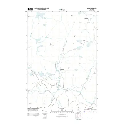
2013 Map of Minerva
USGS Topo · Published 2013About this map
Minerva and Olmstedville anchor this 2013 topographic survey, representing the primary residential hubs in this portion of the Adirondacks. The settlement pattern is largely defined by the drainage of Minerva Stream and the corridor along the Morse Memorial Hwy. In the northern reach, Loch Muller sits near Warrens Pond, while the central hamlet of Irishtown remains a distinct locality. The landscape is characterized by numerous small bodies of water, including Minerva Lake, Stony Pond, and Big Sherman Pond, which are tucked between elevations like Snyder Hill and Bigsby Hill. To the south, Moxham Mountain rises above the Kelso Brook drainage. Local history is evidenced by features such as the Federal Flat Cem, situated near the confluence of Minerva Stream and Kelso Brook, providing a clear record of the area's established burial grounds and lineage.
Find a feature on this map
85 named features on this map. Tap any name to fly to it.
Don’t see what you’re looking for? This feature index may not catch every label — zoom into the map to look around manually.
Map Details
Editions of this 2013 Minerva Map
This is the sole edition of this map. No revisions or reprints were ever made.
Other maps of this area

1895 · North Creek
USGS Topo · 1:62,500

1897 · North Creek
USGS Topo · 1:62,500

1897 · Schroon Lake
USGS Topo · 1:62,500

1898 · Newcomb
USGS Topo · 1:62,500

1898 · Thirteenth Lake
USGS Topo · 1:62,500

1901 · Newcomb
USGS Topo · 1:62,500

1950 · Glens Falls
USGS Topo · 1:250,000

1950 · Utica
USGS Topo · 1:250,000

1953 · Schroon Lake
USGS Topo · 1:62,500

1954 · Newcomb
USGS Topo · 1:62,500