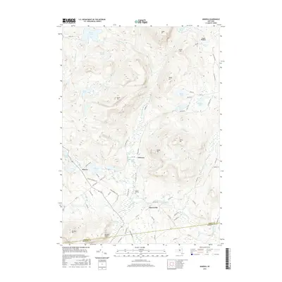
2016 Map of Minerva
USGS Topo · Published 2016About this map
Olmstedville and Minerva serve as the primary hubs of activity in this section of the Adirondacks, where the landscape is defined by a dense network of water bodies and high peaks. The terrain transitions from the heights of Moxham Mtn and Green Mtn down into valleys carved by Minerva Stream and Jones Brook. Local history is anchored by small settlements like Irishtown and Loch Muller, while the Federal Flat Cem provides a specific point of reference for genealogists tracing early residents of Essex County. The map details a sophisticated network of local routes, including AP Morse Memorial Hwy and Loch Muller Rd, which navigate around prominent features such as Minerva Lake and Moxham Pond. This geography illustrates the historical reliance on these mountain passes and stream valleys for travel and settlement in the region's interior.
Find a feature on this map
81 named features on this map. Tap any name to fly to it.
Don’t see what you’re looking for? This feature index may not catch every label — zoom into the map to look around manually.
Map Details
Editions of this 2016 Minerva Map
This is the sole edition of this map. No revisions or reprints were ever made.
Other maps of this area

1895 · North Creek
USGS Topo · 1:62,500

1897 · North Creek
USGS Topo · 1:62,500

1897 · Schroon Lake
USGS Topo · 1:62,500

1898 · Newcomb
USGS Topo · 1:62,500

1898 · Thirteenth Lake
USGS Topo · 1:62,500

1901 · Newcomb
USGS Topo · 1:62,500

1950 · Glens Falls
USGS Topo · 1:250,000

1950 · Utica
USGS Topo · 1:250,000

1953 · Schroon Lake
USGS Topo · 1:62,500

1954 · Newcomb
USGS Topo · 1:62,500