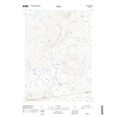
2019 Map of Minerva
USGS Topo · Published 2019About this map
Minerva and Olmstedville anchor this 2019 survey of the Adirondack foothills, where the landscape is defined by a dense network of mountain ponds and small settlements. The town of Minerva sits at the intersection of Minerva Lake Rd and the Morse Memorial Hwy, with the Minerva Baptist Cem nearby. Further east, the hamlet of Irishtown and the remote Loch Muller area reflect the historic settlement patterns of Essex County.
Find a feature on this map
83 named features on this map. Tap any name to fly to it.
Don’t see what you’re looking for? This feature index may not catch every label — zoom into the map to look around manually.
Map Details
Editions of this 2019 Minerva Map
This is the sole edition of this map. No revisions or reprints were ever made.
Other maps of this area

1895 · North Creek
USGS Topo · 1:62,500

1897 · North Creek
USGS Topo · 1:62,500

1897 · Schroon Lake
USGS Topo · 1:62,500

1898 · Newcomb
USGS Topo · 1:62,500

1898 · Thirteenth Lake
USGS Topo · 1:62,500

1901 · Newcomb
USGS Topo · 1:62,500

1950 · Glens Falls
USGS Topo · 1:250,000

1950 · Utica
USGS Topo · 1:250,000

1953 · Schroon Lake
USGS Topo · 1:62,500

1954 · Newcomb
USGS Topo · 1:62,500