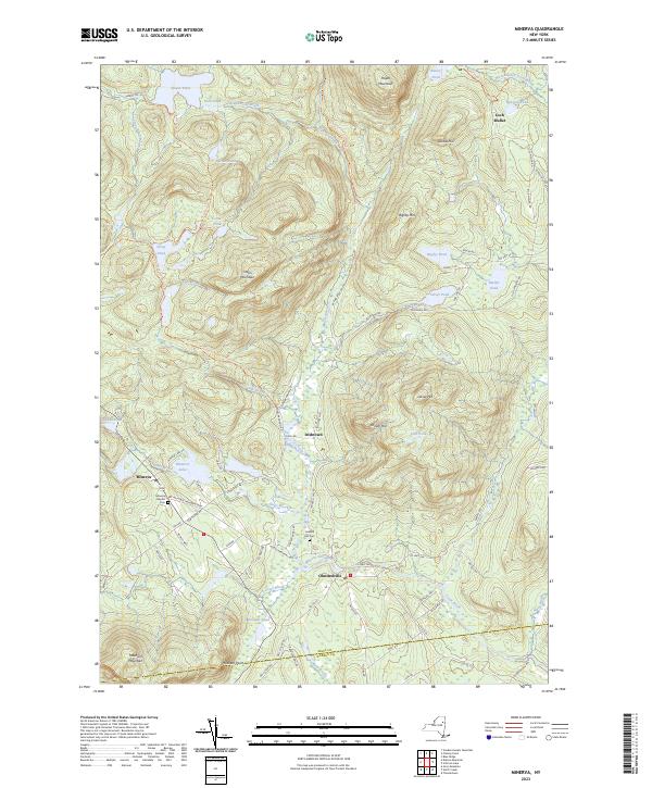
2023 Map of Minerva
USGS Topo · Published 2023About this map
Minerva and Olmstedville anchor the southern reaches of this landscape, where the confluence of Jones Brook and Minerva Stream shapes the local geography. The area's history is preserved at the Minerva Baptist Cem and Federal Flat Cem, while smaller settlements like Irishtown and Loch Muller represent the enduring rural character of the Adirondacks. To the north, the terrain rises significantly toward Hayes Mountain and Green Mountain, broken by numerous water bodies including Hewitt Pond, Barnes Pond, and the secluded Lost Pond. This modern survey details the extensive trail network, such as the Stony Pond Trl and Cheney Pond-Irishtown Trl, that connects these remote heights to the valleys below. The boundary between Essex Co and Warren Co cuts through the southwest, near the prominent Moxham Mountain, illustrating the jurisdictional divisions that have long defined these mountain townships.
Find a feature on this map
88 named features on this map. Tap any name to fly to it.
Don’t see what you’re looking for? This feature index may not catch every label — zoom into the map to look around manually.
Map Details
Editions of this 2023 Minerva Map
This is the sole edition of this map. No revisions or reprints were ever made.
Other maps of this area

1895 · North Creek
USGS Topo · 1:62,500

1897 · North Creek
USGS Topo · 1:62,500

1897 · Schroon Lake
USGS Topo · 1:62,500

1898 · Newcomb
USGS Topo · 1:62,500

1898 · Thirteenth Lake
USGS Topo · 1:62,500

1901 · Newcomb
USGS Topo · 1:62,500

1950 · Glens Falls
USGS Topo · 1:250,000

1950 · Utica
USGS Topo · 1:250,000

1953 · Schroon Lake
USGS Topo · 1:62,500

1954 · Newcomb
USGS Topo · 1:62,500