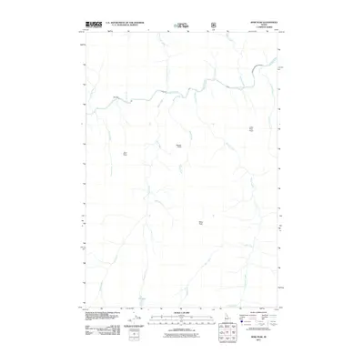
2011 Map of Mink Peak
USGS Topo · Published 2011About this map
The Selway River cuts through this high-country landscape in Idaho County, carving a central drainage fed by a network of steep-gradient tributaries. In this 2011 survey, the terrain is defined by named high points including Mink Peak, Wolf Point, and Weasel Point, which overlook the deep canyons formed by Mink Creek and Marten Creek. The hydrology of the area is particularly complex, featuring high-elevation water bodies like Doe Lake and its outlet, Doe Lake Creek, alongside distinctive riverside landmarks such as Dry Bar. This map illustrates the primitive character of the backcountry before modern development, where landforms like Lone Pine Point served as essential navigation markers for those traversing the river corridor or the surrounding ridges.
Find a feature on this map
21 named features on this map. Tap any name to fly to it.
Don’t see what you’re looking for? This feature index may not catch every label — zoom into the map to look around manually.
Map Details
Editions of this 2011 Mink Peak Map
This is the sole edition of this map. No revisions or reprints were ever made.
Other maps of this area

1911 · Lolo
USGS Topo · 1:250,000

1913 · Lolo
USGS Topo · 1:250,000

1956 · Elk City
USGS Topo · 1:250,000

1956 · Hamilton
USGS Topo · 1:250,000

1959 · Hamilton
USGS Topo · 1:250,000

1960 · Elk City
USGS Topo · 1:250,000

1960 · Hamilton
USGS Topo · 1:250,000

1964 · Hamilton
USGS Topo · 1:250,000

1966 · Moose Ridge
USGS Topo · 1:24,000
1966 · Wylies Peak
USGS Topo · 1:24,000