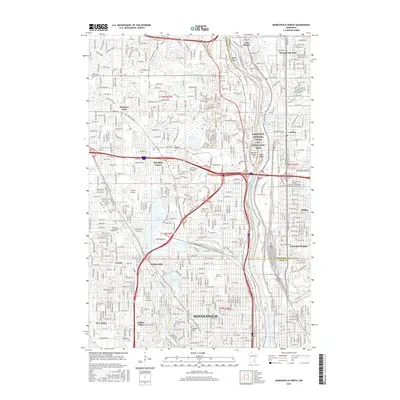
2016 Map of Minneapolis North
USGS Topo · Published 2016About this map
The Mississippi River carves through the heart of this urbanized corridor, defining the border between Hennepin and Anoka counties. Within the Mississippi National River and Recreation Area, several river features remain prominent, including Banfill Island, Durnam Island, and Chase Island. The landscape is a dense network of residential and industrial development across Minneapolis, Brooklyn Center, and Fridley, yet it is punctuated by significant green spaces and water bodies like Palmer Lake and Crystal Lake.
Find a feature on this map
200 named features on this map. Tap any name to fly to it.
Don’t see what you’re looking for? This feature index may not catch every label — zoom into the map to look around manually.
Map Details
Editions of this 2016 Minneapolis North Map
This is the sole edition of this map. No revisions or reprints were ever made.
Other maps of this area

1896 · Minneapolis
USGS Topo · 1:62,500

1896 · St. Paul
USGS Topo · 1:62,500

1901 · Minneapolis
USGS Topo · 1:62,500

1902 · White Bear
USGS Topo · 1:62,500

1902 · Anoka
USGS Topo · 1:62,500

1951 · St. Paul West
USGS Topo · 1:24,000

1951 · St. Paul
USGS Topo · 1:62,500

1952 · Minneapolis North
USGS Topo · 1:24,000

1952 · Minneapolis South
USGS Topo · 1:24,000

1952 · New Brighton
USGS Topo · 1:24,000