
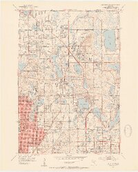
1952 Map of New Brighton
USGS Topo · Published 1954About this map
Twin Cities Arsenal dominates the central landscape of this early 1950s survey, representing a significant military-industrial footprint between the developing suburbs of New Brighton and Arden Hills. The map captures a transitional era for Ramsey County, where large institutional tracts and lakefront properties began to give way to organized residential blocks. A notable network of water bodies, including Lake Johanna, Turtle Lake, and Lake Owasso, are interspersed with essential local infrastructure like the Twin Cities Speedway and several expansive burial grounds such as Sunset Memorial Park Cemetery and Hillside Cemetery.
Find a feature on this map
76 named features on this map. Tap any name to fly to it.
Don’t see what you’re looking for? This feature index may not catch every label — zoom into the map to look around manually.
Map Details
Editions of this 1952 New Brighton Map
2 editions found
Other maps of this area

1896 · Minneapolis
USGS Topo · 1:62,500

1896 · St. Paul
USGS Topo · 1:62,500

1901 · Minneapolis
USGS Topo · 1:62,500

1902 · White Bear
USGS Topo · 1:62,500

1902 · Anoka
USGS Topo · 1:62,500

1951 · St. Paul West
USGS Topo · 1:24,000

1951 · St. Paul East
USGS Topo · 1:24,000

1951 · St. Paul
USGS Topo · 1:62,500

1952 · Centerville
USGS Topo · 1:24,000

1952 · White Bear Lake West
USGS Topo · 1:24,000