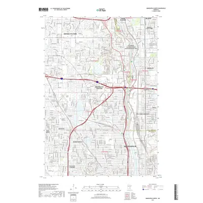
2019 Map of Minneapolis North
USGS Topo · Published 2019About this map
The Mississippi River corridor dominates this 2019 survey, carving through the northern metropolitan landscape of Minneapolis and its surrounding suburbs. This map documents a dense suburban fabric where residential developments are punctuated by significant green spaces and historical burial grounds, including the large Crystal Lake Cem and the Sacred Heart of Jesus Polish National Catholic Cem. The preservation of the riverfront is highlighted by the Mississippi National River and Recreation Area, protecting several river islands such as Banfill Island and Chase Island.
Find a feature on this map
57 named features on this map. Tap any name to fly to it.
Don’t see what you’re looking for? This feature index may not catch every label — zoom into the map to look around manually.
Map Details
Editions of this 2019 Minneapolis North Map
This is the sole edition of this map. No revisions or reprints were ever made.
Other maps of this area

1896 · Minneapolis
USGS Topo · 1:62,500

1896 · St. Paul
USGS Topo · 1:62,500

1901 · Minneapolis
USGS Topo · 1:62,500

1902 · White Bear
USGS Topo · 1:62,500

1902 · Anoka
USGS Topo · 1:62,500

1951 · St. Paul West
USGS Topo · 1:24,000

1951 · St. Paul
USGS Topo · 1:62,500

1952 · Minneapolis North
USGS Topo · 1:24,000

1952 · Minneapolis South
USGS Topo · 1:24,000

1952 · New Brighton
USGS Topo · 1:24,000