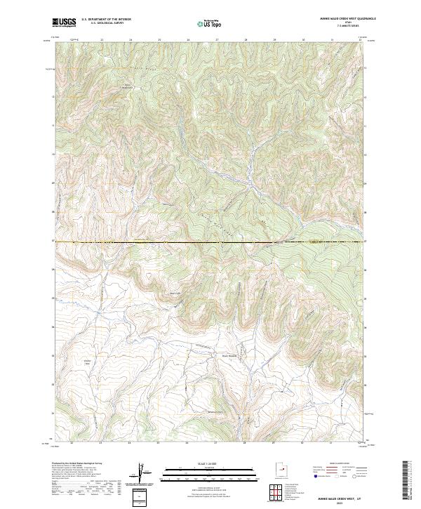
2023 Map of Minnie Maud Creek West
USGS Topo · Published 2023About this map
Minnie Maud Creek winds through this high-altitude landscape along the border of Duchesne Co and Carbon Co. The terrain is defined by dramatic elevation changes where the Roan Cliffs rise above the basin floor, separating expansive plateaus like Emma Park and Whitmore Park. These namesake parks and meadows, such as Brook Meadow, suggest a history of seasonal grazing and high-country ranching in this part of the Uinta Basin.
Find a feature on this map
27 named features on this map. Tap any name to fly to it.
Don’t see what you’re looking for? This feature index may not catch every label — zoom into the map to look around manually.
Map Details
Editions of this 2023 Minnie Maud Creek West Map
This is the sole edition of this map. No revisions or reprints were ever made.
Other maps of this area

1886 · Price River
USGS Topo · 1:250,000

1896 · Price River
USGS Topo · 1:250,000

1914 · Castle Gate
USGS Topo · 1:62,500

1915 · Wellington
USGS Topo · 1:62,500

1916 · Castle Gate
USGS Topo · 1:62,500

1956 · Price
USGS Topo · 1:250,000

1960 · Price
USGS Topo · 1:250,000

1962 · Price
USGS Topo · 1:250,000
1968 · Lance Canyon
USGS Topo · 1:24,000
1968 · Jones Hollow
USGS Topo · 1:24,000