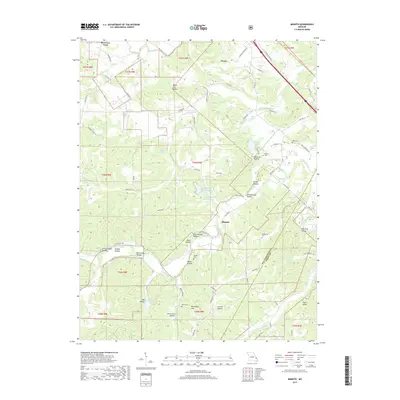
2017 Map of Minnith
USGS Topo · Published 2017About this map
Minnith and Ozora anchor this rural landscape in Ste. Genevieve and Perry Counties, where a network of family-named hollows and ridges defines the settlement pattern. The terrain is marked by numerous small-scale water bodies and named drainages, including the distinctively titled Lake Minnie Ha-Ha Upper and Lake Minnie Ha-Ha Lower. A heavy emphasis on genealogical markers is evident through the scattered locations of family burial grounds like Roth Cem, Brown Cem, and Hand Cem, reflecting the deep-rooted agricultural history of the region.
Find a feature on this map
85 named features on this map. Tap any name to fly to it.
Don’t see what you’re looking for? This feature index may not catch every label — zoom into the map to look around manually.
Map Details
Editions of this 2017 Minnith Map
This is the sole edition of this map. No revisions or reprints were ever made.
Other maps of this area

1907 · Weingarten
USGS Topo · 1:62,500

1909 · Weingarten
USGS Topo · 1:62,500

1910 · Higdon
USGS Topo · 1:62,500

1915 · Chester
USGS Topo · 1:62,500

1923 · Perryville
USGS Topo · 1:62,500

1924 · Perryville
USGS Topo · 1:62,500

1947 · Chester
USGS Topo · 1:62,500

1949 · Paducah
USGS Topo · 1:250,000

1949 · Rolla
USGS Topo · 1:250,000

1950 · Paducah
USGS Topo · 1:250,000