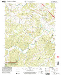
2000 Map of Minnith
USGS Topo · Published 2002About this map
Saline Creek and its many winding tributaries define the topography of this corner of Missouri at the turn of the millennium. The landscape is characterized by a dense network of hollows and ridges, such as Peach Tree Ridge and Opossum Hollow, where small settlements like Minnith and Ozora are established. This 2000 revision shows the area's rural character preserved within the Mark Twain National Forest, balanced by active land use including several Quarries and the Peaceful Valley Camp. Local history is deeply embedded in the land, evidenced by numerous family-named landmarks and burial sites like Roth Cem, Brown Cem, and Hand Cem. The presence of Minnehaha Lake and Donze Lake provides a contrast to the heavily wooded terrain of the hollows.
Find a feature on this map
60 named features on this map. Tap any name to fly to it.
Don’t see what you’re looking for? This feature index may not catch every label — zoom into the map to look around manually.
Map Details
Editions of this 2000 Minnith Map
This is the sole edition of this map. No revisions or reprints were ever made.
Other maps of this area

1907 · Weingarten
USGS Topo · 1:62,500

1909 · Weingarten
USGS Topo · 1:62,500

1910 · Higdon
USGS Topo · 1:62,500

1915 · Chester
USGS Topo · 1:62,500

1923 · Perryville
USGS Topo · 1:62,500

1924 · Perryville
USGS Topo · 1:62,500

1947 · Chester
USGS Topo · 1:62,500

1949 · Paducah
USGS Topo · 1:250,000

1949 · Rolla
USGS Topo · 1:250,000

1950 · Paducah
USGS Topo · 1:250,000