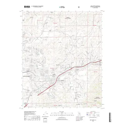
2018 Map of Mint Canyon
USGS Topo · Published 2018About this map
Santa Clarita and its surrounding canyons are captured here in a period of modern expansion, where residential development meets the steep margins of the Angeles National Forest. The map traces the critical infrastructure of the Santa Clara River valley, including the Southern Pacific railroad line and the Los Angeles Aqueduct, which cuts through the northwestern terrain near Haskell Canyon. Traditional settlements like Solemint, Honby, and Humphreys are shown amidst a landscape defined by prominent landforms such as Cruzan Mesa and Del Sur Ridge. The intersection of Soledad Canyon Rd and Golden Valley Rd serves as a central hub for the area's growth, while the eastern reaches near Lang and Tick Canyon retain the rugged character of the San Gabriel Mountains foothills.
Find a feature on this map
53 named features on this map. Tap any name to fly to it.
Don’t see what you’re looking for? This feature index may not catch every label — zoom into the map to look around manually.
Map Details
Editions of this 2018 Mint Canyon Map
This is the sole edition of this map. No revisions or reprints were ever made.
Other maps of this area

1900 · Fernando
USGS Topo · 1:62,500

1901 · Southern California Sheet No. 1
USGS Topo · 1:250,000

1903 · Tejon
USGS Topo · 1:125,000

1903 · Camulos
USGS Topo · 1:125,000

1903 · Santa Susana
USGS Topo · 1:62,500

1904 · Southern California Sheet No. 1
USGS Topo · 1:250,000

1915 · Elizabeth Lake
USGS Topo · 1:125,000

1917 · Elizabeth Lake
USGS Topo · 1:125,000

1925 · Sylmar
USGS Topo · 1:24,000

1928 · Sylmar
USGS Topo · 1:24,000