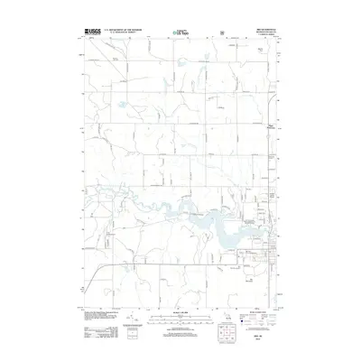
2012 Map of Mio
USGS Topo · Published 2012About this map
The Au Sable River winds through the heart of this landscape, its course interrupted by the Mio Pond and Mio Dam Pond which dominate the central terrain. This section of Oscoda County reflects a mix of outdoor recreation and localized settlement, centered on the community of Mio. To the north, the terrain rises toward Mount Tom, while small clusters of historical interest like Biggs Settlement and Sherwood Corners sit along the grid of rural roads.
Find a feature on this map
107 named features on this map. Tap any name to fly to it.
Don’t see what you’re looking for? This feature index may not catch every label — zoom into the map to look around manually.
Map Details
Editions of this 2012 Mio Map
This is the sole edition of this map. No revisions or reprints were ever made.
Other maps of this area

1949 · Lewiston
USGS Topo · 1:62,500

1950 · Comstock Hills
USGS Topo · 1:24,000

1951 · Comstock Hills
USGS Topo · 1:24,000

1954 · Traverse City
USGS Topo · 1:250,000

1955 · Comins
USGS Topo · 1:62,500

1958 · Traverse City
USGS Topo · 1:250,000

1963 · Luzerne
USGS Topo · 1:24,000

1963 · Red Oak
USGS Topo · 1:24,000

1972 · Mio
USGS Topo · 1:24,000

1972 · Mack Lake
USGS Topo · 1:24,000