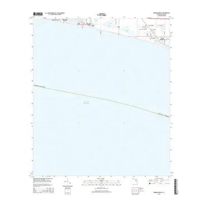
2015 Map of Miramar Beach
USGS Topo · Published 2015About this map
Miramar Beach and the emerald coastline of Walton County are defined by a rare cluster of coastal dune lakes situated just behind the primary dunes. These unique freshwater bodies, including Morris Lake, Campbell Lake, and Stalworth Lake, sit remarkably close to the salt waters of the Gulf of Mexico. The area's geography is further shaped by prominent coastal elevations such as Topsail Hill and the adjacent Topsail Bluff, which provide a distinct vantage point over the shoreline.
Find a feature on this map
36 named features on this map. Tap any name to fly to it.
Don’t see what you’re looking for? This feature index may not catch every label — zoom into the map to look around manually.
Map Details
Editions of this 2015 Miramar Beach Map
This is the sole edition of this map. No revisions or reprints were ever made.
Other maps of this area

1935 · Villa Tasso
USGS Topo · 1:48,000

1936 · Point Washington
USGS Topo · 1:48,000

1938 · Villa Tasso
USGS Topo · 1:62,500

1939 · Point Washington
USGS Topo · 1:62,500

1956 · Villa Tasso
USGS Topo · 1:62,500

1957 · Pensacola
USGS Topo · 1:250,000

1959 · Pensacola
USGS Topo · 1:250,000

1960 · Pensacola
USGS Topo · 1:250,000
1970 · Miramar Beach
USGS Topo · 1:24,000
1970 · Destin
USGS Topo · 1:24,000