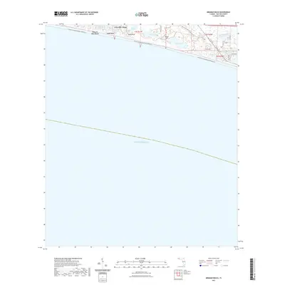
2021 Map of Miramar Beach
USGS Topo · Published 2021About this map
Coastal dune lakes and emerald waters define this Walton County landscape, where the Gulf of Mexico meets a series of unique freshwater basins. Settlements such as Tang-O-Mar Beach, Gulf Pines, and Four-Mile Village occupy the narrow strip of land between the shoreline and the interior forests. The presence of Campbell Lake, Morris Lake, and Fuller Lake just inland from the gulf highlights a rare ecological phenomenon where freshwater and saltwater environments exist in close proximity.
Find a feature on this map
28 named features on this map. Tap any name to fly to it.
Don’t see what you’re looking for? This feature index may not catch every label — zoom into the map to look around manually.
Map Details
Editions of this 2021 Miramar Beach Map
This is the sole edition of this map. No revisions or reprints were ever made.
Other maps of this area

1935 · Villa Tasso
USGS Topo · 1:48,000

1936 · Point Washington
USGS Topo · 1:48,000

1938 · Villa Tasso
USGS Topo · 1:62,500

1939 · Point Washington
USGS Topo · 1:62,500

1956 · Villa Tasso
USGS Topo · 1:62,500

1957 · Pensacola
USGS Topo · 1:250,000

1959 · Pensacola
USGS Topo · 1:250,000

1960 · Pensacola
USGS Topo · 1:250,000
1970 · Miramar Beach
USGS Topo · 1:24,000
1970 · Destin
USGS Topo · 1:24,000