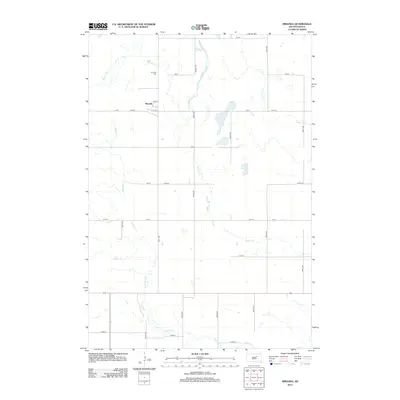
2012 Map of Miranda
USGS Topo · Published 2012About this map
Miranda sits at the heart of this Faulk County landscape, anchored by the intersection of Pine St and 1st St E. The surrounding geography is defined by a dendritic network of prairie waterways, including the winding paths of Medicine Creek and Bryant Creek, which drain the open country alongside Gooder Creek and Dove Creek. This 2012 survey captures the grid-like precision of the rural road system, where long-established routes like 170 St and 362nd Ave partition the land into expansive agricultural blocks. North of the settlement, the Miranda Cem stands as a local landmark for genealogical research, situated near the headwaters of Bryant Creek in an area where the natural drainage patterns contrast with the rigid lines of the section-line roads.
Find a feature on this map
25 named features on this map. Tap any name to fly to it.
Don’t see what you’re looking for? This feature index may not catch every label — zoom into the map to look around manually.
Map Details
Editions of this 2012 Miranda Map
This is the sole edition of this map. No revisions or reprints were ever made.
Other maps of this area

1899 · Northville
USGS Topo · 1:125,000

1899 · Redfield
USGS Topo · 1:125,000

1951 · Orient
USGS Topo · 1:24,000

1951 · Polo
USGS Topo · 1:24,000

1952 · Faulkton East
USGS Topo · 1:24,000

1953 · Huron
USGS Topo · 1:250,000

1954 · Aberdeen
USGS Topo · 1:250,000

1954 · Huron
USGS Topo · 1:250,000

1956 · Aberdeen
USGS Topo · 1:250,000

1966 · Cresbard SE
USGS Topo · 1:24,000