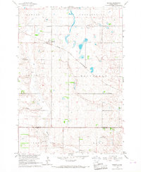
1966 Map of Miranda
USGS Topo · Published 1967About this map
Miranda sits at the intersection of the Chicago and North Western railroad and local roads in this mid-1960s agricultural landscape. The township structure is clearly defined by large survey blocks including Lafoon, Centerville, and Hillsdale. While the settlement of Miranda provides the primary anchor for the area, the map reveals the critical importance of water management and wildlife preservation through the presence of the Gerkin State Wildlife Refuge and numerous wetlands. Evidence of early infrastructure is found at the Miranda Cem, while the natural drainage of the prairie is marked by Dove Creek and Medicine Creek. This survey captures the rural character of the Faulk and Hand County border during a period when the rail line still served as a vital link for the scattered farmsteads and gravel operations.
Find a feature on this map
14 named features on this map. Tap any name to fly to it.
Don’t see what you’re looking for? This feature index may not catch every label — zoom into the map to look around manually.
Map Details
Editions of this 1966 Miranda Map
This is the sole edition of this map. No revisions or reprints were ever made.
Other maps of this area

1899 · Northville
USGS Topo · 1:125,000

1899 · Redfield
USGS Topo · 1:125,000

1951 · Orient
USGS Topo · 1:24,000

1951 · Polo
USGS Topo · 1:24,000

1952 · Faulkton East
USGS Topo · 1:24,000

1953 · Huron
USGS Topo · 1:250,000

1954 · Aberdeen
USGS Topo · 1:250,000

1954 · Huron
USGS Topo · 1:250,000

1956 · Aberdeen
USGS Topo · 1:250,000

1966 · Cresbard SE
USGS Topo · 1:24,000