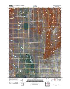
2011 Map of Miranda Flat
USGS Topo · Published 2011About this map
Miranda Flat and the surrounding high desert of Harney County are defined by a network of seasonal watercourses and expansive basin terrain. In this remote stretch of southeastern Oregon, the Fields-Denio Rd serves as the primary north-south corridor, connecting isolated outposts like the Mann Lake Ranch. The landscape is etched by numerous drainage systems, including Mann Creek, Mosquito Creek, and Willow Creek, which flow toward the lower elevations of the Big Basin. These features illustrate the sparse, ranch-driven settlement patterns common to this arid region.
Find a feature on this map
14 named features on this map. Tap any name to fly to it.
Don’t see what you’re looking for? This feature index may not catch every label — zoom into the map to look around manually.
Map Details
Editions of this 2011 Miranda Flat Map
This is the sole edition of this map. No revisions or reprints were ever made.
Other maps of this area

1955 · Adel
USGS Topo · 1:250,000

1957 · Adel
USGS Topo · 1:250,000

1958 · Adel
USGS Topo · 1:250,000

1962 · Adel
USGS Topo · 1:250,000

1968 · Wildhorse Lake
USGS Topo · 1:24,000

1968 · Big Pasture Creek
USGS Topo · 1:24,000

1968 · Alvord Hot Springs
USGS Topo · 1:24,000
1981 · Mann Lake
USGS Topo · 1:24,000

1981 · Miranda Flat SW
USGS Topo · 1:24,000

1981 · Miranda Flat SE
USGS Topo · 1:24,000