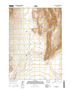
2017 Map of Miranda Flat
USGS Topo · Published 2017About this map
Steens Mtn dominates the western portion of this high desert landscape, giving way to the sprawling expanse of Miranda Flat. This area in Harney County is defined by its complex drainage network, where numerous seasonal watercourses like Buena Vista Cr, Mosquito Cr, and Cottonwood Cr flow toward the lower basins. The presence of Big Springs and the eastern edge of Big Basin highlight the critical water sources and geological depressions that have long shaped land use in this arid environment.
Find a feature on this map
22 named features on this map. Tap any name to fly to it.
Don’t see what you’re looking for? This feature index may not catch every label — zoom into the map to look around manually.
Map Details
Editions of this 2017 Miranda Flat Map
This is the sole edition of this map. No revisions or reprints were ever made.
Other maps of this area

1955 · Adel
USGS Topo · 1:250,000

1957 · Adel
USGS Topo · 1:250,000

1958 · Adel
USGS Topo · 1:250,000

1962 · Adel
USGS Topo · 1:250,000

1968 · Wildhorse Lake
USGS Topo · 1:24,000

1968 · Big Pasture Creek
USGS Topo · 1:24,000

1968 · Alvord Hot Springs
USGS Topo · 1:24,000
1981 · Mann Lake
USGS Topo · 1:24,000

1981 · Miranda Flat SW
USGS Topo · 1:24,000

1981 · Miranda Flat SE
USGS Topo · 1:24,000