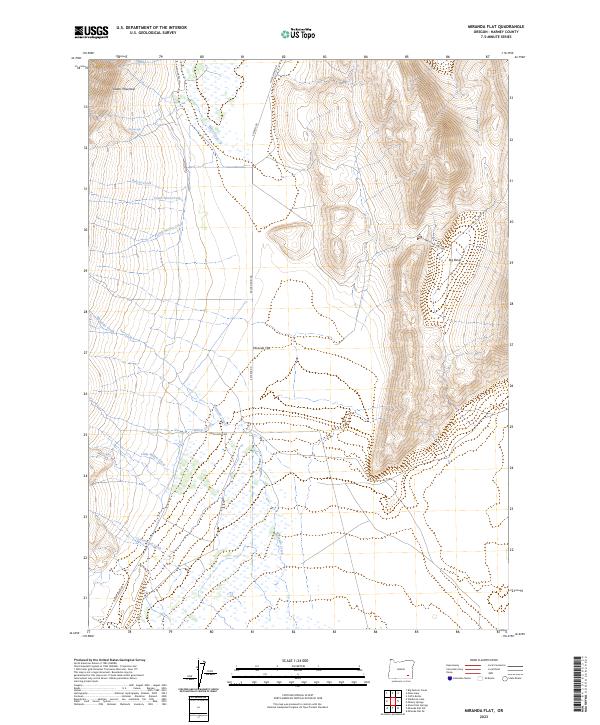
2023 Map of Miranda Flat
USGS Topo · Published 2023About this map
Steens Mountain dominates this portion of Harney County, where steep eastern slopes give way to the broad alluvial expanse of Miranda Flat. This high-desert landscape is defined by its drainage patterns, with numerous ephemeral and perennial watercourses like Bobcat Creek, Castle Rock Creek, and Little McCoy Creek descending from the heights. The interaction between the mountain's topography and the valley floor is visible in the network of ranch and access roads, including E Steens Rd and Fields-Denio Rd, which follow the natural contours of the basin.
Find a feature on this map
20 named features on this map. Tap any name to fly to it.
Don’t see what you’re looking for? This feature index may not catch every label — zoom into the map to look around manually.
Map Details
Editions of this 2023 Miranda Flat Map
This is the sole edition of this map. No revisions or reprints were ever made.
Other maps of this area

1955 · Adel
USGS Topo · 1:250,000

1957 · Adel
USGS Topo · 1:250,000

1958 · Adel
USGS Topo · 1:250,000

1962 · Adel
USGS Topo · 1:250,000

1968 · Wildhorse Lake
USGS Topo · 1:24,000

1968 · Big Pasture Creek
USGS Topo · 1:24,000

1968 · Alvord Hot Springs
USGS Topo · 1:24,000
1981 · Mann Lake
USGS Topo · 1:24,000

1981 · Miranda Flat SW
USGS Topo · 1:24,000

1981 · Miranda Flat SE
USGS Topo · 1:24,000