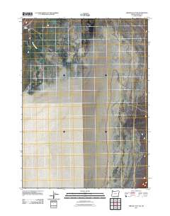
2011 Map of Miranda Flat SW
USGS Topo · Published 2011About this map
Alvord Ranch sits at the base of the rising highlands in Harney County, serving as a rare point of human settlement on the edge of the expansive Alvord Desert. This 2011 survey captures the stark transition between the stark, flat playa of the desert floor and the drainage systems descending from the west, most notably Big Alvord Creek. The map documents the isolation of this corner of Oregon, where the landscape is primarily defined by the intersection of high-desert basins and the vital water sources that sustain the local ranching tradition. The precise contours and 4WD routes shown illustrate the area's role as a destination for desert exploration and a working agricultural landscape.
Find a feature on this map
3 named features on this map. Tap any name to fly to it.
Don’t see what you’re looking for? This feature index may not catch every label — zoom into the map to look around manually.
Map Details
Editions of this 2011 Miranda Flat SW Map
This is the sole edition of this map. No revisions or reprints were ever made.
Other maps of this area

1955 · Adel
USGS Topo · 1:250,000

1957 · Adel
USGS Topo · 1:250,000

1958 · Adel
USGS Topo · 1:250,000

1962 · Adel
USGS Topo · 1:250,000

1968 · Wildhorse Lake
USGS Topo · 1:24,000

1968 · Alvord Hot Springs
USGS Topo · 1:24,000

1971 · Andrews
USGS Topo · 1:24,000

1981 · Tule Springs
USGS Topo · 1:24,000

1981 · Tule Springs NE
USGS Topo · 1:24,000

1981 · Miranda Flat SW
USGS Topo · 1:24,000