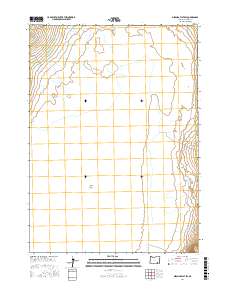
2017 Map of Miranda Flat SW
USGS Topo · Published 2017About this map
The Alvord Desert floor dominates this portion of Harney County, revealing a stark and highly specialized drainage pattern characteristic of the Oregon high desert. In this 2017 study, the vast alkali flat is defined by subtle topographic shifts and ephemeral hydrology, where water from Alvord Cr and Mosquito Cr enters the basin from the north and west. Human presence is concentrated along the western edge of the desert, where the Fields-Denio Rd and Alvord Ranch Ln follow the base of the rising mountains. The map provides a precise layout of the Public Land Survey System sections across t34s r34e and t35s r35e, showing how the land was partitioned even within this seemingly inhospitable playa environment.
Find a feature on this map
9 named features on this map. Tap any name to fly to it.
Don’t see what you’re looking for? This feature index may not catch every label — zoom into the map to look around manually.
Map Details
Editions of this 2017 Miranda Flat SW Map
This is the sole edition of this map. No revisions or reprints were ever made.
Other maps of this area

1955 · Adel
USGS Topo · 1:250,000

1957 · Adel
USGS Topo · 1:250,000

1958 · Adel
USGS Topo · 1:250,000

1962 · Adel
USGS Topo · 1:250,000

1968 · Wildhorse Lake
USGS Topo · 1:24,000

1968 · Alvord Hot Springs
USGS Topo · 1:24,000

1971 · Andrews
USGS Topo · 1:24,000

1981 · Tule Springs
USGS Topo · 1:24,000

1981 · Tule Springs NE
USGS Topo · 1:24,000

1981 · Miranda Flat SW
USGS Topo · 1:24,000