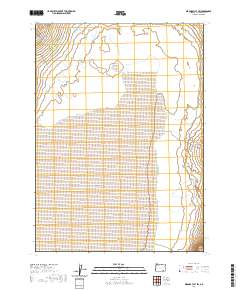
2020 Map of Miranda Flat SW
USGS Topo · Published 2020About this map
Alvord Desert dominates the southern reaches of this landscape, its expansive alkali flat providing a stark contrast to the drainage patterns of the high desert. Along the northwestern edge of the sheet, the presence of Alvord Ranch Ln indicates the long-standing ranching footprint in Harney County, where access follows the base of the mountains to tap into vital water sources. Seasonal flows from Big Alvord Cr and Mosquito Cr define the hydrologic character of the basin, carving ephemeral paths toward the playa floor. This 2020 record of the high desert basin preserves the section lines of the Public Land Survey System, illustrating how grazing and land management remain tied to the Township and Range grid, even in such a sparsely populated environment.
Find a feature on this map
8 named features on this map. Tap any name to fly to it.
Don’t see what you’re looking for? This feature index may not catch every label — zoom into the map to look around manually.
Map Details
Editions of this 2020 Miranda Flat SW Map
This is the sole edition of this map. No revisions or reprints were ever made.
Other maps of this area

1955 · Adel
USGS Topo · 1:250,000

1957 · Adel
USGS Topo · 1:250,000

1958 · Adel
USGS Topo · 1:250,000

1962 · Adel
USGS Topo · 1:250,000

1968 · Wildhorse Lake
USGS Topo · 1:24,000

1968 · Alvord Hot Springs
USGS Topo · 1:24,000

1971 · Andrews
USGS Topo · 1:24,000

1981 · Tule Springs
USGS Topo · 1:24,000

1981 · Tule Springs NE
USGS Topo · 1:24,000

1981 · Miranda Flat SW
USGS Topo · 1:24,000