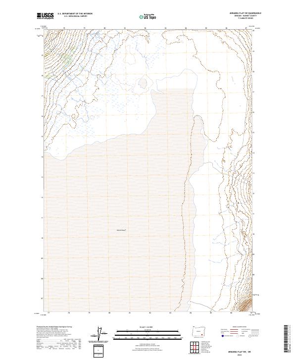
2024 Map of Miranda Flat SW
USGS Topo · Published 2024About this map
The Alvord Desert floor dominates this Harney County landscape, representing one of Oregon's most distinct arid environments. Flowing from the northwest, Big Alvord Creek provides a rare water source to the basin's edge, reflecting the region's reliance on mountain runoff. This modern survey illustrates the intersection of vast public lands and long-standing ranching infrastructure, such as Alvord Ranch Ln. While the desert expanse is largely featureless in its center, the western periphery contains the primary transportation corridor of Fields-Denio Rd, which serves as the lifeline for this remote portion of the state. The map also delineates the precise township and range boundaries for t34s r34e and surrounding sections, offering essential data for land use and property research in the high desert.
Find a feature on this map
8 named features on this map. Tap any name to fly to it.
Don’t see what you’re looking for? This feature index may not catch every label — zoom into the map to look around manually.
Map Details
Editions of this 2024 Miranda Flat SW Map
This is the sole edition of this map. No revisions or reprints were ever made.
Other maps of this area

1955 · Adel
USGS Topo · 1:250,000

1957 · Adel
USGS Topo · 1:250,000

1958 · Adel
USGS Topo · 1:250,000

1962 · Adel
USGS Topo · 1:250,000

1968 · Wildhorse Lake
USGS Topo · 1:24,000

1968 · Alvord Hot Springs
USGS Topo · 1:24,000

1971 · Andrews
USGS Topo · 1:24,000

1981 · Tule Springs
USGS Topo · 1:24,000

1981 · Tule Springs NE
USGS Topo · 1:24,000

1981 · Miranda Flat SW
USGS Topo · 1:24,000