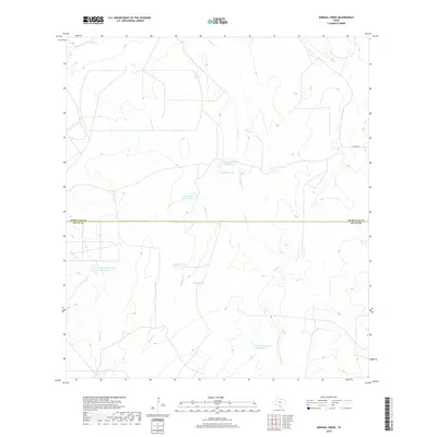
2019 Map of Mirasol Creek
USGS Topo · Published 2019About this map
Duval County Ranch Lake Number 1 and Duval County Ranch Lake Number 2 anchor this landscape along the border of McMullen and Duval Counties. The terrain is defined by a network of drainage systems including Mirasol Cr, Ygnacio Cr, and Juanita Cr, which flow through a region primarily dedicated to ranching and water management. Evidence of local land use is seen in the numerous catchment features such as Rowland Tank and Pulgas Tank, essential for sustaining livestock in this brush country environment.
Find a feature on this map
14 named features on this map. Tap any name to fly to it.
Don’t see what you’re looking for? This feature index may not catch every label — zoom into the map to look around manually.
Map Details
Editions of this 2019 Mirasol Creek Map
This is the sole edition of this map. No revisions or reprints were ever made.
Other maps of this area

1937 · Loma Alta
USGS Topo · 1:62,500

1953 · Crystal City
USGS Topo · 1:250,000

1955 · Crystal City
USGS Topo · 1:250,000

1956 · Freer
USGS Topo · 1:62,500

1956 · Piedra Creek
USGS Topo · 1:62,500

1956 · Las Mujeres
USGS Topo · 1:62,500

1956 · Laredo
USGS Topo · 1:250,000

1961 · Crystal City
USGS Topo · 1:250,000

1968 · Crystal City
USGS Topo · 1:250,000
1969 · Loma Alta NE
USGS Topo · 1:24,000