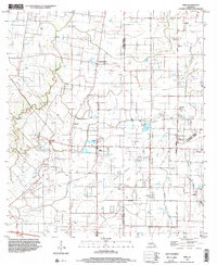
1998 Map of Mire
USGS Topo · Published 2002About this map
Mire and surrounding Acadia Parish settlements occupy a landscape defined by an extensive network of petroleum extraction and drainage bayous at the close of the twentieth century. The map reveals the industrial footprint of the Bosco Oil and Gas Field and North Branch Gas Field, where pipelines and well sites weave between established communities like Higginbotham and Bristol. Smaller rural junctions, including Deshotel and Castille, are connected by a grid of improved and unimproved roads, illustrating the persistent settlement patterns of this prairie region.
Find a feature on this map
27 named features on this map. Tap any name to fly to it.
Don’t see what you’re looking for? This feature index may not catch every label — zoom into the map to look around manually.
Map Details
Editions of this 1998 Mire Map
This is the sole edition of this map. No revisions or reprints were ever made.
Other maps of this area

1934 · Duson
USGS Topo · 1:31,680

1935 · Branch
USGS Topo · 1:31,680

1946 · Lafayette
USGS Topo · 1:31,680

1946 · Rayne
USGS Topo · 1:31,680

1947 · Branch
USGS Topo · 1:31,680

1947 · Pitreville
USGS Topo · 1:31,680

1952 · Lake Charles
USGS Topo · 1:250,000

1954 · Lafayette
USGS Topo · 1:31,680

1954 · Duson
USGS Topo · 1:31,680
1954 · Rayne
USGS Topo · 1:31,680