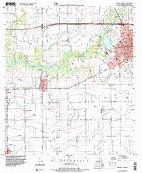
1998 Map of Crowley West
USGS Topo · Published 2000About this map
The western edge of Crowley and its surrounding rice-growing country are defined by an intricate network of flumes, siphons, and canals, indicating the region's intensive irrigation-based agriculture. The landscape is bisected by the winding course of Bayou Plaquemine Brule and Lazy Bayou, which dictate the placement of smaller settlements like Estherwood and Midland. Industrial and aviation history is evidenced by the Le Gros Memorial Airport and the Blue Water Gas Plant, alongside numerous gas wells scattered through the rural sections.
Find a feature on this map
48 named features on this map. Tap any name to fly to it.
Don’t see what you’re looking for? This feature index may not catch every label — zoom into the map to look around manually.
Map Details
Editions of this 1998 Crowley West Map
This is the sole edition of this map. No revisions or reprints were ever made.
Other maps of this area

1935 · Branch
USGS Topo · 1:31,680

1946 · Morse
USGS Topo · 1:31,680

1946 · Mermentau
USGS Topo · 1:31,680

1946 · Kaplan
USGS Topo · 1:31,680

1946 · Rayne
USGS Topo · 1:31,680

1947 · Evangeline
USGS Topo · 1:31,680

1947 · Branch
USGS Topo · 1:31,680

1947 · Iota
USGS Topo · 1:31,680

1949 · Gueydan
USGS Topo · 1:31,680

1949 · Estherwood
USGS Topo · 1:31,680