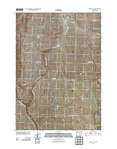
2011 Map of Misery Flat
USGS Topo · Published 2011About this map
The South Fork Crooked River meanders across this high desert landscape of central Oregon, defining the hydrology of a region marked by evocatively named terrain. The open expanse of Misery Flat dominates the eastern portion of the sheet, sitting adjacent to the curiously titled Dust Bowl, suggesting a history of environmental challenges or specific soil conditions encountered by early ranchers and land managers.
Find a feature on this map
7 named features on this map. Tap any name to fly to it.
Don’t see what you’re looking for? This feature index may not catch every label — zoom into the map to look around manually.
Map Details
Editions of this 2011 Misery Flat Map
This is the sole edition of this map. No revisions or reprints were ever made.
Other maps of this area

1955 · Crescent
USGS Topo · 1:250,000

1955 · Burns
USGS Topo · 1:250,000

1957 · Crescent
USGS Topo · 1:250,000

1958 · Crescent
USGS Topo · 1:250,000

1958 · Burns
USGS Topo · 1:250,000

1959 · Burns
USGS Topo · 1:250,000

1970 · Crescent
USGS Topo · 1:250,000

1981 · Hat Butte
USGS Topo · 1:24,000
1981 · Dust Bowl
USGS Topo · 1:24,000
1981 · Ibex Butte
USGS Topo · 1:24,000