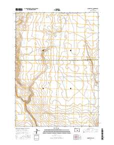
2017 Map of Misery Flat
USGS Topo · Published 2017About this map
Misery Flat dominates this high desert landscape, positioned along the border between Crook and Deschutes counties. This 2017 survey reflects a sparse, arid terrain defined by the intermittent drainage of Buck Cr and a grid of secondary transport routes that serve the region's ranching interests. The presence of S E G I Rd and Schraeder Rd indicates the established land management patterns used for navigating this remote section of the High Desert. The map's detail is focused on the subtle topographic shifts of the flatlands, providing a clear record of the public land survey system lines that delineate large-scale property boundaries in this part of Oregon.
Find a feature on this map
10 named features on this map. Tap any name to fly to it.
Don’t see what you’re looking for? This feature index may not catch every label — zoom into the map to look around manually.
Map Details
Editions of this 2017 Misery Flat Map
This is the sole edition of this map. No revisions or reprints were ever made.
Other maps of this area

1955 · Crescent
USGS Topo · 1:250,000

1955 · Burns
USGS Topo · 1:250,000

1957 · Crescent
USGS Topo · 1:250,000

1958 · Crescent
USGS Topo · 1:250,000

1958 · Burns
USGS Topo · 1:250,000

1959 · Burns
USGS Topo · 1:250,000

1970 · Crescent
USGS Topo · 1:250,000

1981 · Hat Butte
USGS Topo · 1:24,000
1981 · Dust Bowl
USGS Topo · 1:24,000
1981 · Ibex Butte
USGS Topo · 1:24,000