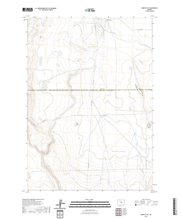
2023 Map of Misery Flat
USGS Topo · Published 2023About this map
Gilchrist Valley forms the central focus of this high desert landscape, where the seasonal drainage of Buck Creek carves a path through the arid plateau. The terrain is defined by its isolation and the surveyor's grid, with the county line between Crook Co and Deschutes Co bisecting the quadrangle. Early infrastructure is represented by a sparse network of dirt roads, including Buck Creek Rd and Schraeder Rd, which provide the only access across these vast townships. The map illustrates a section of Central Oregon where the land remains largely undivided, preserved in its natural state with few permanent structures, reflecting the ranching and open-range character of the region. Researchers can trace the precise boundaries of t21s r22e and surrounding townships, which were essential for establishing land claims and navigating the remote volcanic terrain.
Find a feature on this map
10 named features on this map. Tap any name to fly to it.
Don’t see what you’re looking for? This feature index may not catch every label — zoom into the map to look around manually.
Map Details
Editions of this 2023 Misery Flat Map
This is the sole edition of this map. No revisions or reprints were ever made.
Other maps of this area

1955 · Crescent
USGS Topo · 1:250,000

1955 · Burns
USGS Topo · 1:250,000

1957 · Crescent
USGS Topo · 1:250,000

1958 · Crescent
USGS Topo · 1:250,000

1958 · Burns
USGS Topo · 1:250,000

1959 · Burns
USGS Topo · 1:250,000

1970 · Crescent
USGS Topo · 1:250,000

1981 · Hat Butte
USGS Topo · 1:24,000
1981 · Dust Bowl
USGS Topo · 1:24,000
1981 · Ibex Butte
USGS Topo · 1:24,000