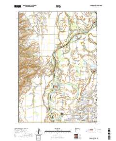
2020 Map of Mission Bottom
USGS Topo · Published 2020About this map
The Willamette River defines the central geography of this mid-Willamette Valley region, winding through a complex of bars, islands, and sloughs. This landscape is characterized by its alluvial bottomlands, notably Mission Bottom and French Prairie, which transition into the prominent Eola Hills and Jerusalem Hill to the west. The river's historical importance is evident in the numerous named gravel bars such as Wheatland Bar and Matheny Bar, as well as distinctive features like Windsor Island and Darrow Chute.
Find a feature on this map
129 named features on this map. Tap any name to fly to it.
Don’t see what you’re looking for? This feature index may not catch every label — zoom into the map to look around manually.
Map Details
Editions of this 2020 Mission Bottom Map
This is the sole edition of this map. No revisions or reprints were ever made.
Other maps of this area

1915 · Rickreall
USGS Topo · 1:31,680

1915 · Eola
USGS Topo · 1:31,680

1917 · Salem
USGS Topo · 1:62,500

1923 · Mount Angel
USGS Topo · 1:62,500

1924 · Mc Minnville
USGS Topo · 1:48,000

1925 · Stayton
USGS Topo · 1:62,500

1926 · Mc Minnville
USGS Topo · 1:62,500

1940 · McMinnville
USGS Topo · 1:62,500

1940 · Salem
USGS Topo · 1:62,500

1940 · Mount Angel
USGS Topo · 1:62,500