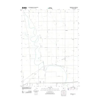
2012 Map of Mission Hill
USGS Topo · Published 2012About this map
The winding James River dominates this landscape north of Yankton, carving through the alluvial terrain of South Dakota. In the early 21st century, this area exhibits a transition between the established agricultural grid and emerging residential development. The small settlement of Valleyview sits near the center of the sheet, while the Rosenberg Cem provides a point of genealogical interest to the east. The river's influence on local infrastructure is evident in the naming of regional thoroughfares like Ne Jim River Rd, Sw Jim River Rd, and S Jim River Rd. To the west, the drainage of Beaver Cr feeds into the larger river system, shaping the topography around Cedar Bluff Rd. Residential pockets are visible through smaller roads such as Van Osdel Ter and Chris Rd, reflecting the modern expansion of rural Yankton County.
Find a feature on this map
45 named features on this map. Tap any name to fly to it.
Don’t see what you’re looking for? This feature index may not catch every label — zoom into the map to look around manually.
Map Details
Editions of this 2012 Mission Hill Map
This is the sole edition of this map. No revisions or reprints were ever made.
Other maps of this area

1898 · Parker
USGS Topo · 1:125,000

1955 · Sioux City
USGS Topo · 1:250,000

1955 · Sioux Falls
USGS Topo · 1:250,000

1957 · Gayville
USGS Topo · 1:24,000

1957 · Mayfield
USGS Topo · 1:24,000

1957 · Mission Hill
USGS Topo · 1:24,000

1957 · Jamesville
USGS Topo · 1:24,000

1958 · Sioux City
USGS Topo · 1:250,000

1958 · Sioux Falls
USGS Topo · 1:250,000

1959 · Sioux City
USGS Topo · 1:250,000