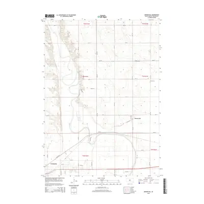
2015 Map of Mission Hill
USGS Topo · Published 2015About this map
The James River snakes through this landscape of the Great Plains, carving a wide valley floor as it moves toward its confluence just south of Yankton. This 2015 survey illustrates a rural-urban transition where the northeastern outskirts of the city meet the agricultural expanses of Yankton County. The small community of Mission Hill sits along a traditional grid of section roads, while newer developments like Valleyview and residential corridors such as Van Osdel Ter suggest the modern expansion of the regional hub.
Find a feature on this map
42 named features on this map. Tap any name to fly to it.
Don’t see what you’re looking for? This feature index may not catch every label — zoom into the map to look around manually.
Map Details
Editions of this 2015 Mission Hill Map
This is the sole edition of this map. No revisions or reprints were ever made.
Other maps of this area

1898 · Parker
USGS Topo · 1:125,000

1955 · Sioux City
USGS Topo · 1:250,000

1955 · Sioux Falls
USGS Topo · 1:250,000

1957 · Gayville
USGS Topo · 1:24,000

1957 · Mayfield
USGS Topo · 1:24,000

1957 · Mission Hill
USGS Topo · 1:24,000

1957 · Jamesville
USGS Topo · 1:24,000

1958 · Sioux City
USGS Topo · 1:250,000

1958 · Sioux Falls
USGS Topo · 1:250,000

1959 · Sioux City
USGS Topo · 1:250,000