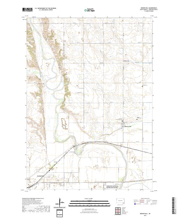
2021 Map of Mission Hill
USGS Topo · Published 2021About this map
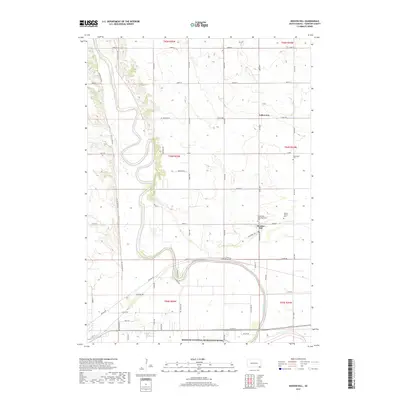
James River meanders south through the fertile lands of Yankton County, defining the agricultural character of this region. The settlement of Mission Hill serves as a local hub, situated near historical community centers like the Mission Hill Congregational Cem and Vangen Church. The landscape is a network of section-line roads and river-bottom terrain, with the Beaver Cr feeding into the main waterway. To the north, the small community of Valleyview sits among the rolling topography, while the southern edge of the map reaches the outskirts of Yankton and the protected corridor of the Missouri National Recreation River. This 2021 survey documents a landscape where modern infrastructure intersects with long-established rural landmarks, including the Rosenberg Cem and Vangen Church Cem, which remain vital touchpoints for local family history.
Find a feature on this map
39 named features on this map. Tap any name to fly to it.
Don’t see what you’re looking for? This feature index may not catch every label — zoom into the map to look around manually.
Map Details
Editions of this 2021 Mission Hill Map
This is the sole edition of this map. No revisions or reprints were ever made.
Historical Maps of Yankton Through Time
5 maps found
Featured Locations
- Marindahl Township, SD
- Mission Hill, SD
- Mission Hill North Township, SD
- Yankton, SD
- Valleyview, Mission Hill North Township