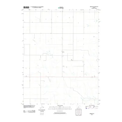
2010 Map of Missler
USGS Topo · Published 2010About this map
Missler sits in the heart of this Meade County landscape, where the high plains of Southwest Kansas are defined by a strictly surveyed section-line road system. The township-and-range grid is evident in the regular intervals of routes like Co Rd 11 and J Rd, which partition the agricultural landscape. Cutting through this geometric order is the natural drainage of Spring Creek, which meanders from the northwest toward the south, joined by the topographic depression of Hart Draw in the central-east. The primary transportation corridor, 160 54, bisects the southern portion of the quadrangle. This 2010 survey illustrates the persistence of small rural settlements and the enduring spatial patterns of Kansas ranching and dryland farming, where water sources like Spring Creek remain the primary irregular features against an otherwise disciplined landscape of rural roads.
Find a feature on this map
16 named features on this map. Tap any name to fly to it.
Don’t see what you’re looking for? This feature index may not catch every label — zoom into the map to look around manually.
Map Details
Editions of this 2010 Missler Map
This is the sole edition of this map. No revisions or reprints were ever made.
Other maps of this area

1892 · Meade
USGS Topo · 1:125,000

1955 · Dodge City
USGS Topo · 1:250,000

1958 · Dodge City
USGS Topo · 1:250,000

1959 · Dodge City
USGS Topo · 1:250,000

1962 · Irish Flats NE
USGS Topo · 1:24,000

1963 · Plains
USGS Topo · 1:24,000

1963 · Kismet NE
USGS Topo · 1:24,000

1963 · Lake Larrabee
USGS Topo · 1:24,000

1963 · Meade
USGS Topo · 1:24,000

1963 · Missler
USGS Topo · 1:24,000