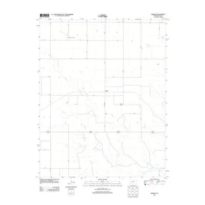
2012 Map of Missler
USGS Topo · Published 2012About this map
The settlement of Missler sits at the center of this 2012 study of rural Meade County, where the high plains landscape is defined by a precise grid of section-line roads and the winding path of Spring Cr. This environment illustrates the transition between upland prairie and the drainage systems of the southern plains, with Hart Draw cutting through the terrain to the east of the main settlement. Civil aviation is represented by Jenkinson Airport in the northern portion of the map, serving as a landmark in an area otherwise dedicated to expansive agricultural use. To the southeast, Big Springs provides a rare concentrated water feature in this arid landscape. The road network, including the eponymous Missler Rd, follows a strict Cartesian layout typical of the American West, highlighting how modern infrastructure maintains the historical township and range system.
Find a feature on this map
22 named features on this map. Tap any name to fly to it.
Don’t see what you’re looking for? This feature index may not catch every label — zoom into the map to look around manually.
Map Details
Editions of this 2012 Missler Map
This is the sole edition of this map. No revisions or reprints were ever made.
Other maps of this area

1892 · Meade
USGS Topo · 1:125,000

1955 · Dodge City
USGS Topo · 1:250,000

1958 · Dodge City
USGS Topo · 1:250,000

1959 · Dodge City
USGS Topo · 1:250,000

1962 · Irish Flats NE
USGS Topo · 1:24,000

1963 · Plains
USGS Topo · 1:24,000

1963 · Kismet NE
USGS Topo · 1:24,000

1963 · Lake Larrabee
USGS Topo · 1:24,000

1963 · Meade
USGS Topo · 1:24,000

1963 · Missler
USGS Topo · 1:24,000