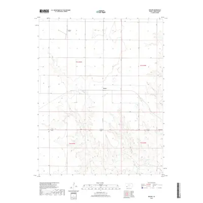
2018 Map of Missler
USGS Topo · Published 2018About this map
Missler sits at the heart of this Meade County landscape, where the agricultural grid meets the winding drainages of the High Plains. The terrain is defined by the incision of Spring Cr and the drainage of Hart Draw, which carve through the south-central sections of the map. This 2018 survey reveals the persistent structure of rural Kansas, anchored by a systematic network of section roads like H RD and 14 RD. The presence of the Jenkinson Airport in the northern portion indicates the continuing importance of private aviation for large-scale ranching and farming operations. To the south, the natural landmark of Big Springs provides a focal point for local hydrology near the intersection of the primary regional transit corridor, 54 160, and the intriguing label at N Carthage.
Find a feature on this map
26 named features on this map. Tap any name to fly to it.
Don’t see what you’re looking for? This feature index may not catch every label — zoom into the map to look around manually.
Map Details
Editions of this 2018 Missler Map
This is the sole edition of this map. No revisions or reprints were ever made.
Other maps of this area

1892 · Meade
USGS Topo · 1:125,000

1955 · Dodge City
USGS Topo · 1:250,000

1958 · Dodge City
USGS Topo · 1:250,000

1959 · Dodge City
USGS Topo · 1:250,000

1962 · Irish Flats NE
USGS Topo · 1:24,000

1963 · Plains
USGS Topo · 1:24,000

1963 · Kismet NE
USGS Topo · 1:24,000

1963 · Lake Larrabee
USGS Topo · 1:24,000

1963 · Meade
USGS Topo · 1:24,000

1963 · Missler
USGS Topo · 1:24,000