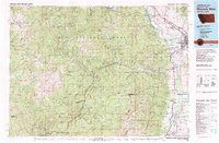
1981 Map of Missoula West
USGS Topo · Published 1981About this map
Missoula serves as the gateway to this expansive mountain landscape, where the Bitterroot River and Lolo Creek carve through the valley floor. The 1981 survey illustrates the complex intersection of federal lands, including the Lolo National Forest and the Selway-Bitterroot Wilderness. Toward the western edge, the remote headwaters of the Middle Fork Clearwater Wild and Scenic River and the Lochsa River define the Idaho border country.
Find a feature on this map
126 named features on this map. Tap any name to fly to it.
Don’t see what you’re looking for? This feature index may not catch every label — zoom into the map to look around manually.
Map Details
Editions of this 1981 Missoula West Map
2 editions found
Other maps of this area

1901 · Hamilton
USGS Topo · 1:125,000

1903 · Bonner
USGS Topo · 1:125,000

1909 · Sapphire
USGS Topo · 1:125,000

1911 · Lolo
USGS Topo · 1:250,000

1912 · Missoula
USGS Topo · 1:125,000

1913 · Lolo
USGS Topo · 1:250,000

1918 · St Regis
USGS Topo · 1:125,000

1919 · St. Regis
USGS Topo · 1:125,000

1921 · Elbow Lake
USGS Topo · 1:125,000

1947 · Butte
USGS Topo · 1:250,000